Mannar Travel Guide
Mannar Island guide: the baobab tree, Mannar Fort, Adam's Bridge, flamingos at Vankalai, and how to get there.
Guides for Mannar
Mannar sits at the end of a causeway in northwestern Sri Lanka, an island barely above sea level and connected to the mainland by a single road. The terrain is flat, dry, and wind-scoured — unlike anything else in Sri Lanka. The nearest large town is Vavuniya, around 95km east. Colombo is roughly 330km away by road.
Mannar sees very few tourists. There is no surf culture here, no beach bar scene, minimal guesthouses, and limited transport connections. What it has is a set of genuinely unusual experiences — the Adam’s Bridge view, a 800-year-old baobab tree, significant bird migration, and a historical layering that goes back to the Arab trade routes — that reward the effort to get there. Sri Lanka north coast tours that include Mannar and the northern circuit are bookable in advance.
The Baobab Tree
Mannar’s most photographed landmark is a massive baobab tree near the old fort, estimated to be around 800 years old. Baobabs are not native to Sri Lanka — local tradition attributes this tree to Arab traders who brought seeds from the East African coast during the medieval period of Indian Ocean trade. Whether that specific account is accurate, baobabs in Mannar are documented anomalies: there is a small population on the island, all believed to have arrived with traders.
The tree is enormous by any standard — several metres in diameter at the trunk — and stands in contrast to the dry scrubland around it. It is accessible and worth seeing.
Mannar Fort
The Portuguese built the first fort at Mannar in 1560. The Dutch expanded it significantly in the 17th century. The structure is large — a proper star fort with bastions and a sea-facing position — but poorly maintained. The walls are substantially intact; the interior is largely overgrown and crumbling. It is not curated heritage; it is a large ruin in the process of slow decay.
That said, it is interesting precisely because it has not been sanitised. The fort gives a clear picture of how the Portuguese and Dutch used island positions to control maritime trade routes around the island. Entry is free and informal.
Adam’s Bridge (Ram Setu)
Talaimannar, at the western tip of Mannar Island, is the closest point in Sri Lanka to India. Adam’s Bridge — known as Ram Setu in Hindu tradition — is a chain of limestone shoals that stretches from Talaimannar toward Rameswaram in Tamil Nadu. The total distance across is about 30km. The shoals are visible from the tip of the island, particularly at low tide.
In the Ramayana, Ram Setu is the causeway built by the monkey army to cross to Lanka. The geological reality is a naturally formed chain of shoals with some evidence of historical land bridges during lower sea levels. The significance in Hindu tradition draws Tamil pilgrims to Talaimannar, particularly at auspicious times.
Talaimannar is about 30km from Mannar town — a tuk-tuk ride of 45–60 minutes. There is essentially nothing at the tip beyond the lighthouse, the sea view, and the pilgrim presence.
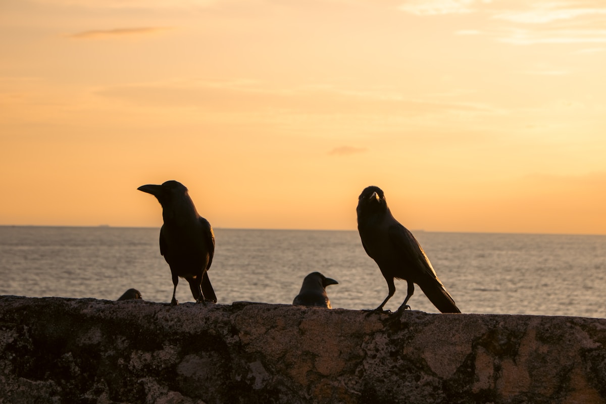
Vankalai Sanctuary and Flamingos
The Vankalai Wetland Sanctuary covers a section of the Mannar Island coastline and the adjacent lagoon. The area is a significant bird migration point — over 100 migratory species pass through between November and January, including waders and shorebirds arriving from the Eurasian and Central Asian steppes.
Flamingos visit the lagoon shallows seasonally, and in good years the flocks can be large. The exact timing varies; ask locally when you arrive about current conditions. Access is by road to the sanctuary entrance and then on foot along the waterline. There is no organised wildlife tourism infrastructure — bring binoculars.
Getting to Mannar
By train: A rail line connects Mannar to Colombo via Vavuniya, running in approximately seven to eight hours. The service is infrequent — check current schedules. This is not a scenic or comfortable journey by Sri Lankan standards but is an option.
By bus: Bus from Vavuniya to Mannar takes around two hours and is the most practical option if you are combining a Jaffna–Mannar circuit going south.
By private vehicle: Mannar is most flexibly explored with a hired vehicle or motorbike. Roads on the island are sealed but narrow.
Practical Realities
Tourist facilities in Mannar are minimal. The town has a few basic guesthouses (ask locally — nothing is reliably listed online). There are small local restaurants serving rice and curry. ATMs are present in Mannar town but not always stocked.
For most visitors, Mannar works best as a full-day trip from Vavuniya, or as a stop on a self-drive circuit of the north (Jaffna → Mannar → Vavuniya or in reverse). Spending the night is possible and gives you the early morning bird activity at Vankalai, but requires lower expectations around comfort.
The reward for the inconvenience is a completely unmediated experience of a part of Sri Lanka that the tourist infrastructure has not yet reached.
More in Mannar
Mannar sits on the natural route between Jaffna and the rest of the island. From Jaffna, most travellers route south via Vavuniya — Mannar is a worthwhile detour westward on a self-drive circuit. If you’re coming from Colombo, Negombo and Kalpitiya on the northwest coast are en route and can be combined in a northern loop. The solo travel guide has useful advice on navigating less-touristed northern areas independently.
- Things to Do in Mannar
- Where to Stay in Mannar
- Jaffna travel guide
- Kalpitiya travel guide
- Solo travel in Sri Lanka
Related Guides
- Wilpattu National Park — 65km south; leopards and lakes in Sri Lanka’s largest national park
- Anuradhapura travel guide — the ancient capital on the route south from Mannar
- Getting around Sri Lanka — self-drive vs hiring a driver for northern Sri Lanka
- Hiring a driver in Sri Lanka — recommended for the Mannar circuit given limited public transport
- 3-week Sri Lanka itinerary — the northern loop that includes Mannar, Jaffna, and Anuradhapura
Frequently Asked Questions
- What is the ancient baobab tree in Mannar?
- The baobab tree near Mannar Fort is estimated to be around 800 years old and several metres in diameter at the trunk. Baobabs are not native to Sri Lanka — local tradition attributes this tree to Arab traders who brought seeds from the East African coast during the medieval Indian Ocean trade period. It is accessible and one of the more unusual sights in northern Sri Lanka.
- What is Adam's Bridge and can I see it from Mannar?
- Adam's Bridge (Ram Setu) is a chain of limestone shoals stretching from Talaimannar at the western tip of Mannar Island toward Rameswaram in Tamil Nadu, India. The shoals are visible from the tip of the island at low tide. Talaimannar is about 30km from Mannar town — a 45–60 minute tuk-tuk ride. There is essentially nothing at the tip beyond the lighthouse and the sea view.
- How do I get to Mannar from Jaffna or Colombo?
- From Jaffna, travel south to Vavuniya then west to Mannar by bus (around 2 hours from Vavuniya). A rail line also connects Mannar to Colombo via Vavuniya in approximately 7–8 hours, but the service is infrequent. By private vehicle, Mannar is most flexibly reached on a self-drive circuit of the north.
- Can I see flamingos at Vankalai Sanctuary in Mannar?
- Flamingos visit the Vankalai Wetland lagoon shallows seasonally, and in good years the flocks are large. Over 100 migratory bird species also pass through between November and January. There is no organised wildlife tourism infrastructure — bring binoculars and ask locally about current conditions. Access is on foot along the waterline from the sanctuary entrance.
- Is Mannar Fort worth visiting?
- Yes, for visitors interested in colonial military history. The Portuguese built the first fort in 1560 and the Dutch expanded it significantly in the 17th century. The walls are largely intact but the interior is overgrown and crumbling — it is a genuine ruin rather than a curated heritage site. Entry is free and informal.
- How long should I spend in Mannar?
- Mannar works best as a full-day trip from Vavuniya, or as a stop on a self-drive north Sri Lanka circuit (Jaffna → Mannar → Vavuniya). Spending the night is possible and gives you early morning bird activity at Vankalai, but accommodation is basic with nothing reliably listed online. Ask locally on arrival.
Book an experience
Top experiences in Mannar
Explore the best tours and activities in Mannar — instant confirmation, free cancellation on most bookings.