Tea Country Trekking: Hiking in Sri Lanka's Hill Country
Book an experience
Book this activity
These are the top-rated activities for this area — book ahead to lock in your preferred date.
Sri Lanka’s central highlands — the hill country — offer some of the most rewarding trekking in South Asia. The landscape combines tea estates, cloud forest, waterfalls, and grassland moorland at elevations between 1,000 and 2,500 metres. The towns of Ella and Nuwara Eliya serve as the main trekking bases; the Knuckles Range north of Kandy is the most serious mountain terrain.
Compared to Nepal or India, the trail infrastructure is limited. Most routes are unmarked or use local footpaths; hiring a guide for anything beyond the standard day hikes is worth considering.
Ella Area
Little Adam’s Peak
The most accessible hill walk from Ella town. A broad, well-worn path rises through tea estate to a summit at 1,141 metres with clear views of Ella Gap, the valley below, and Ella Rock on the opposite side. The round trip takes 1.5–2 hours at a relaxed pace. No guide needed. The path starts 3km from Ella town — walkable or by tuk-tuk.
The trail continues beyond Little Adam’s Peak into the tea estates — you can walk through to the Nine Arches Bridge in about 1.5 hours from the summit, though the path requires asking locals for directions at junctions.
Ella Rock
A longer and more demanding alternative to Little Adam’s Peak. The route follows the railway tracks from Ella station for 2km before branching up through forest to the summit at 1,140 metres. The trail is steep and partially unmarked in the upper section. Round trip: 4–5 hours.
Views from the top are broader than Little Adam’s Peak and include Ella Gap in both directions. Guides (available through Ella guesthouses) are helpful for the upper section where the path isn’t obvious. Carry water — there’s no source on the route.
Ravana Falls and Surrounds
A number of walking routes use Ravana Falls (on the Ella–Wellawaya road, 6km from Ella town) as a starting or ending point. The falls themselves are a tourist stop; the walks above and around them through forest are quieter. A guide is needed for the upper sections.
Horton Plains National Park
Horton Plains is a plateau at 2,100–2,300 metres, classified as a national park and one of the best-preserved cloud forest ecosystems in Asia. The mandatory loop walk (approximately 9km, 3–4 hours) passes through grassland moorland and montane forest to World’s End — a sheer 880-metre cliff dropping abruptly to the southern lowlands.
World’s End view: best before 9am, when cloud rolls in from the south. Most visitors arrive by 6:30–7am. By 10am the cliff is frequently cloud-covered. The loop also passes Baker’s Falls, a 20-metre waterfall in the forest section.
Getting there: Horton Plains is 32km from Nuwara Eliya by road. Tuk-tuks and taxis are the standard transport. No public bus goes directly to the park entrance.
Entry fees: USD $25 per person (foreigners). Guides are not mandatory but are required for trails beyond the main loop. The park opens at 6am.
What to bring: the plateau is cold and exposed — temperatures at 6am are 8–14°C. A windproof layer, water, and breakfast (you’ll be there for 4 hours) are essential. The montane forest section is often wet.
Wildlife: sambar deer are abundant on the grasslands, often seen in groups at sunrise. Sri Lanka leopard and fishing cat are present but rarely seen. The endemic Sri Lanka whistling thrush and dull-blue flycatcher are both found here.
Knuckles Range (Knuckles Conservation Forest)
The Knuckles Range northeast of Kandy is Sri Lanka’s most serious trekking terrain — a UNESCO-listed cloud forest area with genuine multi-day routes, steep ridge lines, and villages accessible only on foot. Elevations reach 1,863 metres at Gombaniya Peak.
Standard access: from Kandy, drive to Riverston or Corbets Gap (both approximately 2 hours) for ridge walks with views over the range. These are day walks requiring no specialist equipment.
Multi-day treks: 2–3 day guided circuits through the Knuckles interior are possible, staying in village homestays or basic camping. These require a licensed guide (essential for navigation), camping permits, and decent physical fitness. The terrain involves steep ascents and descents on narrow paths.
Leeches: the Knuckles is notorious for leeches during the wet season (May–August on the west side). Leech socks and insect repellent help but don’t eliminate the problem. The dry season (December–April) is more comfortable.
Guides: arrange through Kandy guesthouses or specialist operators. An experienced local guide who knows the Knuckles interior trails makes a significant difference to route-finding and pace.
Adam’s Peak (Sri Pada)
Adam’s Peak stands at 2,243 metres in the southern edge of the central highlands. It is primarily a pilgrimage site — a footprint near the summit is sacred to Buddhists, Hindus, Muslims, and Christians — but the climb is undertaken by thousands of trekkers as well.
The climbing season is December to May, when the trail is lit and warungs (food stalls) are open on the route. Outside this period the trail is dark and many food stalls are closed. The main route from Dalhousie involves approximately 5,200 steps and takes 3–4 hours up. Dawn arrivals see the famous shadow of the peak projected over the lowlands as the sun rises behind it — this requires a night start (1–2am from Dalhousie).
The off-season (June–November) is technically possible but the trail is unmaintained, stalls are closed, and the footprint shrine is locked.
Practical Notes
Best trekking season: December–April (dry season in the hill country). May–August brings rain to the western slopes. September–November is mixed.
Leeches: common in forest areas during and after rain. Leech socks (available in Ella and Kandy) are useful if you’re sensitive to them.
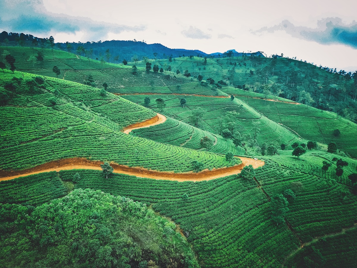
Tea estate paths: most tea estate walking paths are on private land. Workers and estate managers are generally tolerant of walkers but access is informal rather than right of way. Ask permission where a path enters a working estate.
Altitude: the higher routes (Horton Plains, upper Knuckles) can feel cold and affect breathing for people coming from sea level. Most visitors adapt quickly, but allow a day in Ella or Nuwara Eliya before attempting sustained elevation.
Frequently Asked Questions
- What is the best time of year for trekking in Sri Lanka's hill country?
- December to April is the dry season in the hill country and the most reliable trekking period. May to August brings rain to the western slopes. September to November is mixed. The Knuckles Range is most comfortable December to April due to leeches being far less active outside the wet season.
- Do I need a guide for hiking in Sri Lanka's hill country?
- Little Adam's Peak near Ella doesn't require a guide. Ella Rock is manageable without one but guides help on the unmarked upper section. Horton Plains has a mandatory loop walk that needs no guide, but trails beyond the main loop do. Multi-day treks in the Knuckles Range require a licensed guide for navigation.
- How hard is the hike to Ella Rock?
- Ella Rock is more demanding than Little Adam's Peak — a 4–5 hour round trip with a steep, partially unmarked upper section. The route follows the railway tracks from Ella station before ascending through forest to 1,140 metres. Carry water as there is no source on the route.
- What time should I arrive at Horton Plains to see World's End clearly?
- Arrive by 6:30–7am. World's End is best viewed before 9am — by 10am, cloud typically rolls in from the south and the 880-metre cliff is obscured. The park opens at 6am; entry costs USD $25 per person for foreigners.
- How long does the Horton Plains loop walk take?
- The mandatory loop is approximately 9km and takes 3–4 hours at a moderate pace. It passes through grassland moorland and montane forest to World's End and also visits Baker's Falls, a 20-metre waterfall in the forest section.
- What is the Knuckles Range like for trekking?
- The Knuckles Range northeast of Kandy is Sri Lanka's most serious trekking terrain — a UNESCO-listed cloud forest with genuine multi-day routes, steep ridges, and villages accessible only on foot. Elevations reach 1,863 metres. Multi-day circuits require a licensed guide, camping permits, and decent physical fitness.
Ready to explore?
Browse hundreds of tours and activities. Book securely with free cancellation on most options.
Browse on GetYourGuide →We may earn a small commission — at no extra cost to you.